
Last modified: 2026-03-21 by martin karner
Keywords: giv'at shmuel |
Links: FOTW homepage |
search |
disclaimer and copyright |
write us |
mirrors
See also:
![[Local Council of Giv'at Shmuel (Israel)]](../images/i/il-lcgsm.gif) image modified by Dov Gutterman | 2:3    Emblem adopted 30th July 1959 |
Local Council Giv'at Shemuel (meaning Samuel's hill,
after Shemuel Pinales, a Zionist leader from Romania) is situated
on east Gush Dan, on highway 4, bordering Ramat
Gan, Petah Tikva, Bene Berak and Qiryat
Ono. Est. 1942, a Local Council since 1948. Pop. 13'000.
The municipal emblem was published in the official gazette (Rashumot),
'Publications Gazette' section (Yalkut ha'Pirsumim), YP
690, 30 July 1959.
Source: letter and flag image from Mr Eyal, Local
Council, September 2001; council
website [retrieved].
Dov Gutterman, 21 October 2001
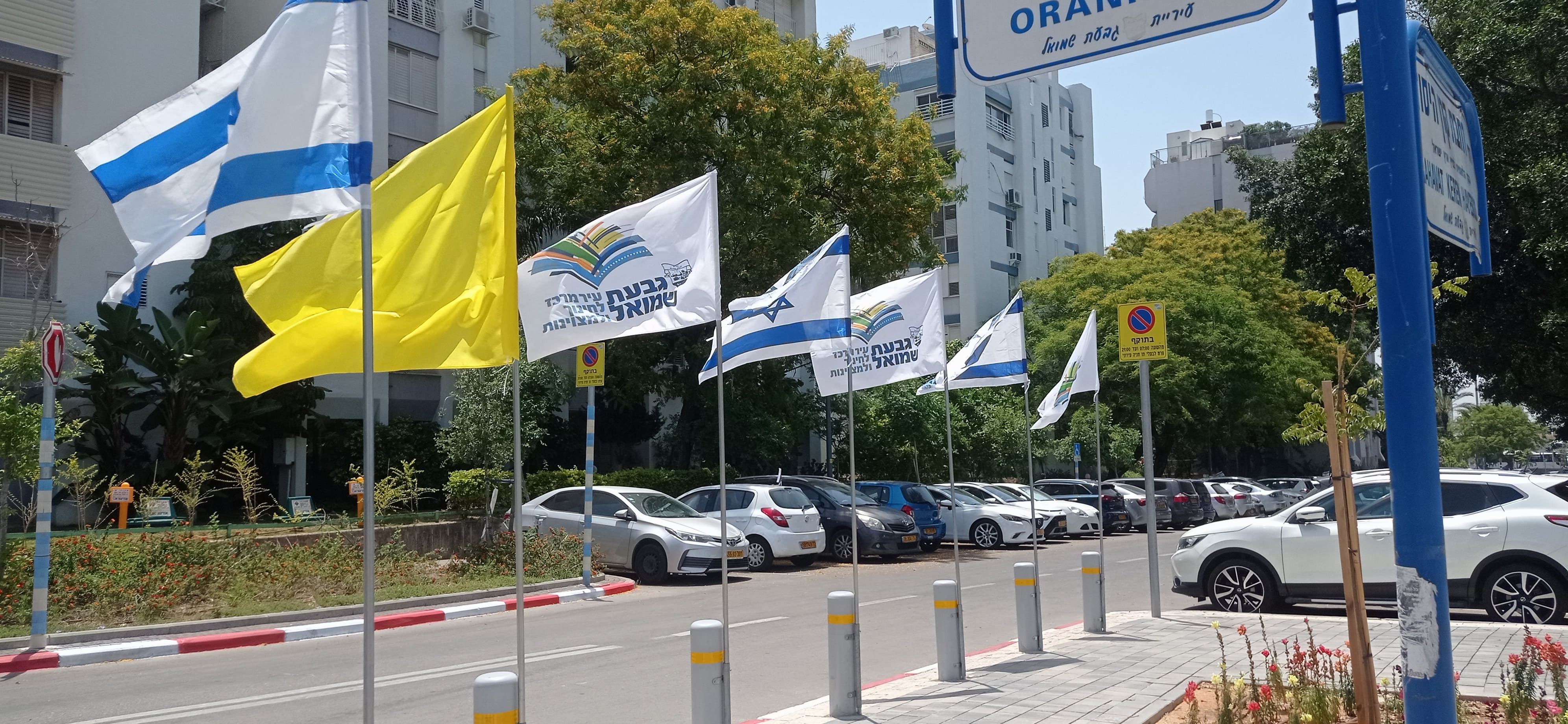
I had the opportunity to see the yellow on green flag (in
vertical form) during TV reports on the local basketball team.
However, It seems that Giv'at Shmuel had changed its flag or had
a previous flag combined of the municipal emblem on
"national" background as appeared in now defunct photos
at the municipal
site.
Dov Gutterman, 12 April 2005
History (givat-shmuel.muni.il [retrieved from 2007], English translation)
![[CoA]](../images/i/il)gvtshm.gif)
(source)
![[logo70]](../images/i/il-gvtshm_log70.gif)
(source)
Logo for 70th anniversary. Inscription: עיר חדכז לחינון ולמצויינות (City dedicated to education and excellence).
![[flag]](../images/i/il-gvtshm.jpg)