
Last modified: 2012-12-29 by ian macdonald
Keywords: sao paulo | balbinos |
Links: FOTW homepage |
search |
disclaimer and copyright |
write us |
mirrors
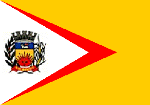 image by Ivan Sache, 19 December 2012
Source:
http://www.balbinos.sp.gov.br/historia.htm
A yellow-orange field with a red equilateral triangle extending from the hoist, overlain by a white isosceles triangle also extending from the hoist, and bearing the municipal arms.
Official website at
http://www.balbinos.sp.gov.br
Dirk Schönberger, 24 September 2012
The municipality of Balbinos (3,932 inhabitants in 2010; 9,086 ha) is located in center-western São Paulo State, 420 km of São Paulo and 70 km of Bauru.
Balbinos is named for the Balbino family, who settled in the region in
the early 20th century. The settlement of São João do Balbino was
established in 1926. Following the clearing of the forest to grow
grains and coffee, several families joined the new settlement. The
district of São João do Balbino, part of the municipality of Pirajuí,
was established on 21 January 1935 by Decree-Law no. 6,913.
In the 1940s, Pirajuí was the first producer of coffee in the world
and the district of São João do Balbino counted more than 10,000
inhabitants, coffee covering 80% of the area of arable land.
The municipality of Balbinos was established on 30 December 1953 and
inaugurated on 24 January 1954, the day of St. John the Baptist, the
patron saint of the town.
http://www.balbinos.sp.gov.br/historia.htm - Municipal website
Photo of the flag:
http://balbinos.esporteblog.com.br/8084/Balbinos-esteve-presente-na-abertuda-da-COPA-TVTEM-DE-FUTSAL
Ivan Sache, 19 December 2012