
Last modified: 2025-08-02 by rob raeside
Keywords: saskatchewan | esterhazy |
Links: FOTW homepage |
search |
disclaimer and copyright |
write us |
mirrors
![[Esterhazy]](../images/c/ca-skezy.gif) image by Daniel Rentería, 29 July 2025
image by Daniel Rentería, 29 July 2025
See also:
The flag can be seen in Google Maps (https://maps.app.goo.gl/cALs9uGhp2sPKrud7)
for 2013 and 2009. It depicted the town logo; it appears the flag stopped
being used by 2022, after the adoption of a new logo. The existence of a
current flag is unknown. The old logo depicted an orange mining plant
referencing potash mining operations, as Esterhazy has the title of being the
potash capital of the world. Green lines have the shape of hills referencing
its nearby landscape, along with water referencing the river it is next to.
The sun shines over these elements. Underneath, "Town of Esterhazy" was read
in blue italic text.
Daniel Rentería, 29 July 2025
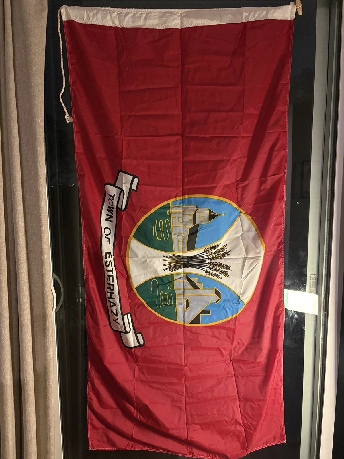
![[Esterhazy]](../images/c/ca-skezy2.jpg) image located by Daniel Rentería, 29 July 2025
image located by Daniel Rentería, 29 July 2025
Source:
https://i.ebayimg.com/images/g/YHkAAeSwpEVoUjpb/s-l1600.webp
The first flag depicted the old logo in the center on a red field. Underneath
the circular logo was its name in a ribbon, reading "TOWN OF ESTERHAZY". The
circular logo depicted three vertical sections, with the ones on the sides
having a circular shape. The left section depicts the Our Lady of the Assumption
Kaposvar church in its surroundings, a church of Hungarian origins from 1906.
The right side depicts a flour mill, another historic monument to the area. In
the center is a sheaf of wheat, referencing part of its economy which is in
agriculture.
Daniel Rentería, 29 July 2025
![[Esterhazy]](../images/c/ca-skezy-l.gif) image by Daniel Rentería, 29 July 2025
image by Daniel Rentería, 29 July 2025
Source: https://www.facebook.com/photo/?fbid=3241099952768108