
This page is part of © FOTW Flags Of The World website
Clickable map of Spodnjeposavska and Dolenjska (Slovenia)
Last modified: 2013-06-22 by ivan sache
Keywords: spodnjeposavska | dolenjska |
Links: FOTW homepage |
search |
disclaimer and copyright |
write us |
mirrors
See also:
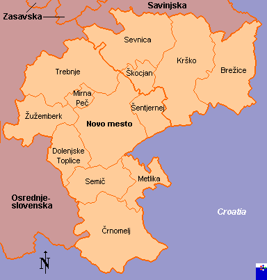
Civic municipalities in bold font.
Map as of October 2002 - Municipalities of Kostanjevica na Krki (Spodnjeposavska), Mokronog - Trebelno, Straža, Šentrupert and Šmarješke Toplice (Jugovzhodna Slovenia), all formed in 2006, not shown - Dolenjska renamed Jugovzhodna Slovenia and increased with Škocjan (from Spodnjeposavska), Kočevje, Kostel, Loški Potok, Osilnica, Ribnica and Sodražica (all from Osrednjeslovenska).
Copyright: FOTW Spodnjeposavska and Dolenjska map by
António Martins and Željko Heimer
and boundaries’ data by
Jarig Bakker.
If you wish to reuse them on your website, read our
copyright rules.