
Last modified: 2018-12-15 by rob raeside
Keywords: eemsmond |
Links: FOTW homepage |
search |
disclaimer and copyright |
write us |
mirrors
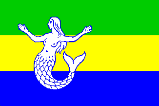 Shipmate Flagchart : http://www.flagchart.net
adopted 27 Jun 1991
![[Eemsmond Coat of Arms]](../images/n/nl-gr)em.jpg) image from this site.
image from this site.
Granted 1 Jan 1990 - Ex Undis is Latin, meaning (wrestled) out of the
waves.
![[Uithuizen flag]](../images/n/nl-gr_uh.gif) Shipmate Flagchart : http://www.flagchart.net
Shipmate Flagchart : http://www.flagchart.net
Uithuizen is all arable land with huge farms and some old castles. It
adopted a flag on 2 Feb 1950, derived partly from
the Coat of Arms, pointing at the green meadows, the yellow corn and the deep
blue sea (actually at that point not so very deep).
Jarig Bakker, 5 Jun 2003
![[Uithuizermeeden flag]](../images/n/nl-gr_um.gif) Shipmate Flagchart : http://www.flagchart.net
Shipmate Flagchart : http://www.flagchart.net
Uithuizermeeden was the northernmost municipality of mainland Netherlands,
and Roodeschool its northernmost village. To celebrate that there was a
bar open 24 hours a day (in the 1960's). The municipality adopted a flag
on 5 Jun 1973.
Jarig Bakker, 5 Jun 2003
![[Warffum flag]](../images/n/nl-gr_wf.gif) Shipmate Flagchart : http://www.flagchart.net
Shipmate Flagchart : http://www.flagchart.net
Warffum is a former municipality in Groningen; since 1990 it is part
of the municipality of Eemsmond, and it continues to use its symbols as
village flag and Coat of Arms. Warffum used to be the northernmost municipality
of the Netherlands, as it contained the islands of Rottum, Rottumeroog,
and Rottumerplaat (all ininhabited, but for a lonely writer, like Godfried
Bomans, and later Jan Wolkers, who stayed there for a while to get the
feeling of real loneliness.
In 1980 the municipality considered the adoption of a flag, to be used
on festive occasions. In its meeting of 31 Oct 1985 the municipal council
resolved to adopted a municipal flag with the following description:
"Red, white, and red, proportioned 2:1:2, with towards the hoist a
white Maltese cross, the height of which is equal to 3/10 of flagheight"..
Jarig Bakker, 6 Jun 2003
![[Warffum Coat of Arms]](../images/n/nl-gr)wf.gif) image from Ralf Hartemink's site
image from Ralf Hartemink's site
At this webpage
is the lengthy story of Warffum's Coat of Arms and flag:
Coat of Arms: In "van der Aa's Aardrijkskundig Woorden boek der Nederlanden,
12de deel, 1849" one reads: The arms of Warffum consists of three gutted
herrings. c. 1900 the municipal council was considering its arms. In the
meeting of 29 Jul 1902 Burgemeester (Mayor) Bijlsma produced a design with
a standing sword with two Maltese crosses. The council decided to send
a request to the Queen to allow them to use the new arms. The High Council
of Nobility (advisory council to the Minister of Justice) objected, because
of what van der Aa had written. Moreover the High Council was able to note
that there was in Bieuwketil in olden times a pub with a signboard, which
depicted three fishes. The Council asked itself whether that pub in former
times had served as court- or council house.
The Master of the Rolls in the province of Groningen, Mr. J.A. Feith
persuaded the Council that the pub had not been a courthouse and that the
image on the signboard had been the Coat of Arms of the noble family of Clant. Members
of that family had lived on the Breedenborg castle. He also pleaded the
case of the proposed Coat of Arms. The name of Warffum (Warfhem or Werfhem) was
mentioned already in charters of 1000; it was explained as "heem", the
place, where the "Warf" was held. The Warf is in the old Frisian law the
public meeting where law was administered. In the late Middle Ages the
Warf became a Court of Appeal. So Warffum had been an old court of law
and the sword was justified. The two Maltese crosses symbolize the presence
of the former monastery of Maltese knights in Warffum, which was known
for the vast extent of its possessions.
On 12 Oct 1903 the Queen granted Warffum its Coat of Arms.
Since some years the former pub "Rust een weinig" (rest a while)
along the towing-path to Onderdendam at the Bieuwketil has a signboard
with the three fishes.
Jarig Bakker, 6 Jun 2003