Last modified: 2017-11-11 by bruce berry
Keywords: portulano | dourado (fernăo vaz) |
Links: FOTW homepage |
search |
disclaimer and copyright |
write us |
mirrors
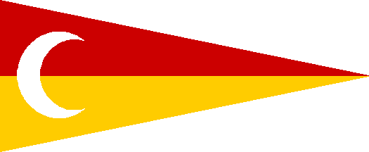
so-1576 - Placed in southern Somalia, near the place where today lies Mogadiscio. A triangular flag, dark red over dark yellow, with a white crescent at the hoist, vertically centered.
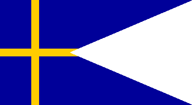
ke-1576 - Placed in Kenya. A deep swallowtail, dark blue, with a thin dark yellow "Scandinavian" cross. There may be something in the canton, but I'm not sure.
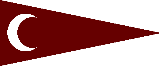
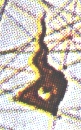
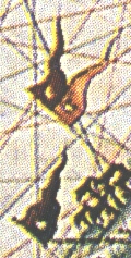
tz-1576n - Placed in northern Tanzania. A triangular flag, very dark red (nearly maroon), with a white crescent at the hoist.
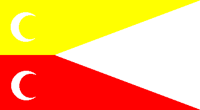
tz-1576s - Placed in central Tanzania, in front of the islands of Zanzibar, Pemba and Mafia (may be Dar-es-Salaam). Another deep swallowtail, divided yellow over red, with two white crescents at the hoist, centered vertically in each stripe.
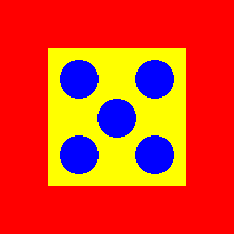
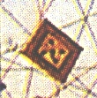
mz-1576n - Placed in northern Mozambique. The flag is square, yellow bordered in red, with five blue bezants disposed in saltire in the yellow square. This is evidently a portuguese flag, but one I never saw before.
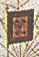
mz-1576s - Placed in southern Mozambique. Another square flag, yellow bordered in blue, with a red templar cross in the yellow square. Another unknown to me Portuguese flag.
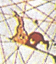
za-1576n - Placed in eastern Transvaal. The flag is like tz-1576s, except that is lighter and the colours are reversed.
za-1576s - Placed in SE South Africa or Swaziland. The flag is very similar to tz-1576n, except that this one is really maroon.
za-1576w - Placed to the south of the Orange river's mouth. The flag is identical to mz-1576n.
km-1576 - Placed in the Comoros archipelago and is yet another version of the Portuguese maritime trade flags, a yellow field with five red bezants disposed per saltire, that is, za-1576w and mz-1576n without the red border and with the bezants red instead of blue:
Are these flags really the flags
used by those places at the time? Or, rephrasing the question: are these
maps reliable in what concerns flag-info (they are not in what concerns
geo-info, that's for sure)
Jorge Candeias, 04 Apr 1998